KALAMAZOO, MI (WKZO AM/FM) – Another blast of winter weather is taking aim at West Michigan later beginning this evening.
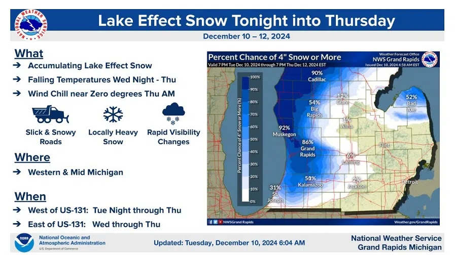
A Winter Storm Watch from the National Weather Service stretches from the Kalamazoo area northward through the Grand Rapids area and up the western shoreline through Muskegon, Grand Traverse area and Charlevoix, and also includes Cadillac.
The western Lake Superior shoreline counties in the Upper Peninsula are also in the Winter Storm Watch. All total, 24 counties in Michigan are included.
The Winter Storm Watch is in effect from 7:00 p.m. Tuesday until 7:00 p.m. Thursday. Forecasters says anywhere in the watch area can expect at least six inches of snow, with some areas getting up to to 12 inches of snow by Thursday evening. The exception with less than six inches of snow would be east of Grand Rapids, where lake-effect snow is expected to will taper off.
Winds will also be strong and gusty in the heavy lake-effect snow area. Wind gusts up to 35 mph will produce significant blowing and drifting in the Winter Storm Watch area Thursday and Thursday night.


Comments